Glassy Mtn
| Site Name: | Glassy Mtn | 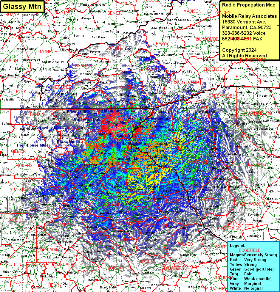 Glassy Mtn Coverage |
| Latitude: | 034 50 44.4N | 34.8456667 |
| Longitude: | 083 29 58.4W | -83.4995556 |
| Feet | Meters | |
| Ground Elevation: | 3435.0 | 1047.0 |
| HAAT: | 1294.0 | 394.4 |
| City: | Clayton | |
| County: | Rabun | |
| State: | Georgia |
This is not an MRA Owned Site. For space rental contact the site owner.
Do you own or manage this site? Click Here
Would you like to add a site to the Google Earth Map?? Click Here
Site Coverage: Coverage of Harbersham, Stephens and Franklin Counties, most of White, Lumpkin, Forsyth, Dawson, Union, Towns, Rabun, Oconee (SC), Pickens (SC), Anderson (SC), Abbeyville (SC), Spartanburg (SC), Gilbert, Madison, Jackson, Banks, Clarke, Barrow, Oconee, Walton, Gwinnett, Forsyth, Dawson, Lumpkin Counties, some of McCormick (SC), Greenwood (SC), Laurens (SC), Union (SC), Lincoln, Wilkes, Taliaferro, Greene, Morgan, Putnam, Jasper, Newton, Rockdale, De Kalb, Clayton, Fulton, Gwinnett, Cobb, CHerokee, Pickens, Gilmer, Murray, Fannin, Union, Lumpkin, Polk (TN), Monroe (TN), CHerokee (NC), Graham (NC), Clay (NC), Macon (NC), Jackson (NC), Swain (NC), Haywood (NC), Transylvania (NC), Henderson (NC) and Polk (NC) Counties