High House Mtn
| Site Name: | High House Mtn | 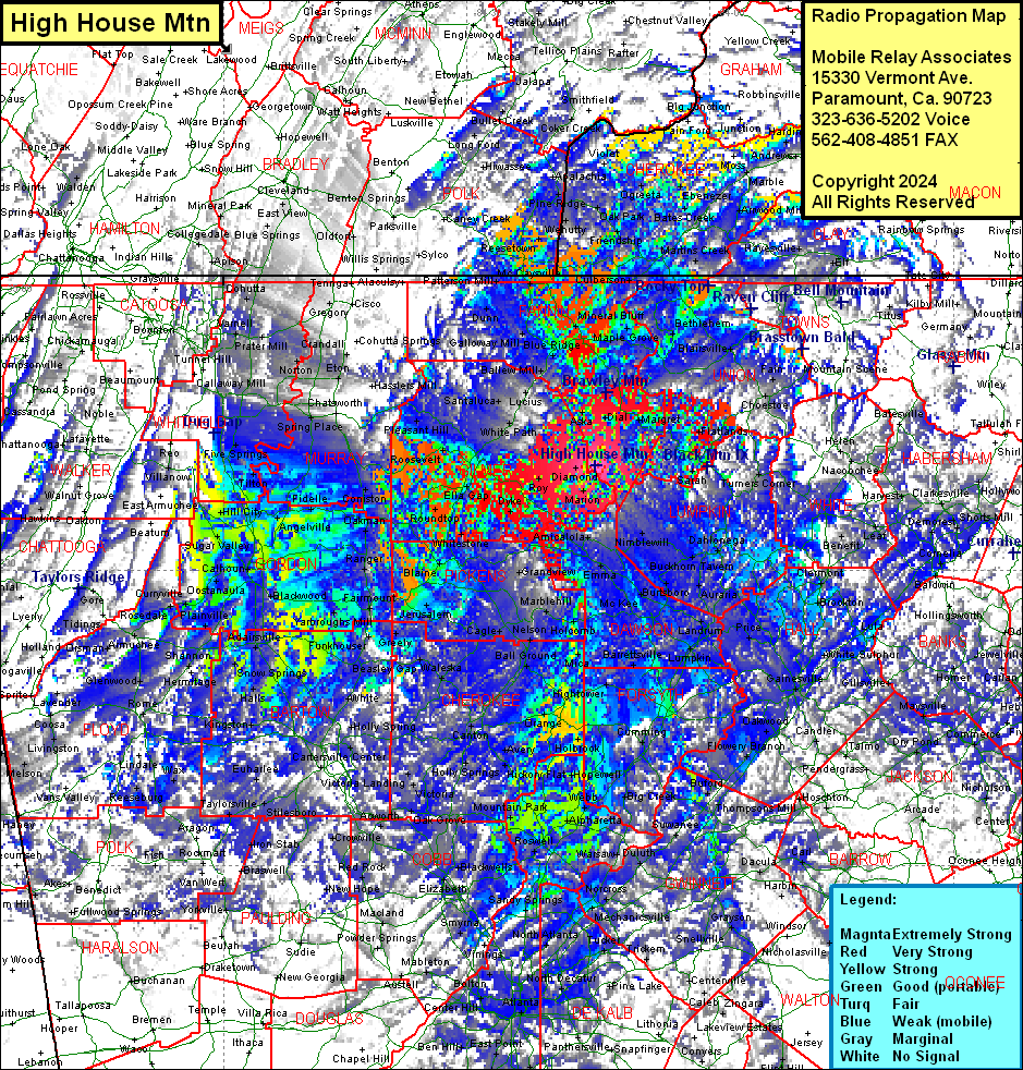 High House Mtn Coverage |
| Latitude: | 034 40 36.6N | 34.6768333 |
| Longitude: | 084 14 11.2W | -84.2364444 |
| Feet | Meters | |
| Ground Elevation: | 3417.0 | 1041.5 |
| HAAT: | 1224.3 | 373.2 |
| City: | Newport | |
| County: | Fannin | |
| State: | Georgia |
This is not an MRA Owned Site. For space rental contact the site owner.
Do you own or manage this site? Click Here
Would you like to add a site to the Google Earth Map?? Click Here
Site Coverage: Coverage of most of Fannin, Union, Lumpkin, Dawson, Forsyth, Gilmer, Pickens, Hall, Clay (NC), Cherokee (NC), some of Fulton, Cobb, Paulding, Polk, Gwinnett, Harralson, Floyd, Chattooga, Walker, Dada, Whitfield, Murray, Gordon, Bartow, Douglas, Clayton, Rockdale, DeKalb, Newton, Walton, Jackson, Barrow, Madison, Hart, Stephens, Franklin, Oconee, Macon (NC), Jackson (NC), Swain (NC), Graham (NC), Cherokee (NC), Polk (TN), Bradley (TN), Hamilton (TN), Marion (TN), Sequatchie (TN), Bledsoe (TN), Cumberland (TN), Loudon (TN), Roane (TN), Monroe (TN), Knox (TN), Cherokee (AL), DeKalb (AL) Counties