Triangle Mtn
| Site Name: | Triangle Mtn | 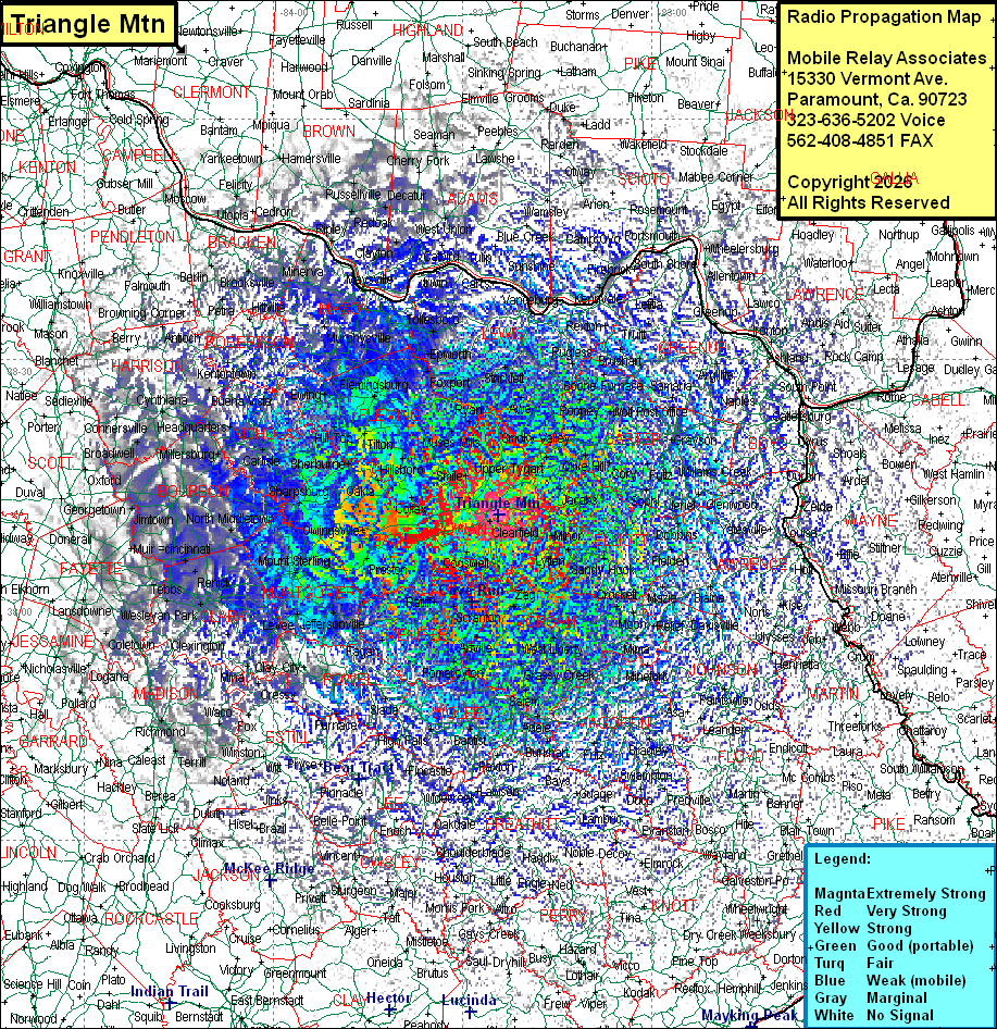 Triangle Mtn Coverage |
| Latitude: | 038 10 38.0N | 38.1772222 |
| Longitude: | 083 24 18.0W | -83.4050000 |
| Feet | Meters | |
| Ground Elevation: | 1390.0 | 423.7 |
| HAAT: | 551.1 | 168.0 |
| City: | Moorhead | |
| County: | Rowan | |
| State: | Kentucky |
This is not an MRA Owned Site. For space rental contact the site owner.
Do you own or manage this site? Click Here
Would you like to add a site to the Google Earth Map?? Click Here
Site Coverage: Coverage of Rowan, Bath, Fleming, Carter Counties, some of Lewis, Mason, Greenup, Boyd, Elliott, Lawrence, Johnson, Martin, Floyd, Magoffin, Morgan, Wolfe, Menifee, Powell, Clark, Montgomery, Bourbon, Nicholas, Robertson, Harrison, Fayette, Madison, Garrard, Jessamine, Scott, Owen, Grant, Pendleton, Campbell, Kenton Counties and sporatic coverage of Cabell (WV), Wayne (WV), MIngo (WV), Lincoln ((WV), Pike, Rockcastle, Garrard, Woodford, Owen, Grant, Kenton, Campbell Counties