Caberfae Harrietta
| Site Name: | Caberfae Harrietta | 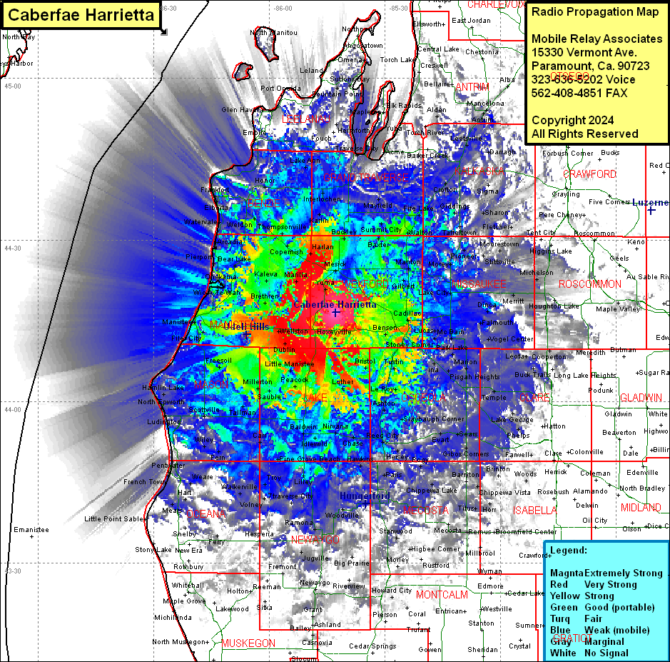 Caberfae Harrietta Coverage |
| Latitude: | 044 16 33.6N | 44.2760000 |
| Longitude: | 085 42 47.9W | -85.7133056 |
| Feet | Meters | |
| Ground Elevation: | 1422.0 | 433.4 |
| HAAT: | 543.0 | 165.5 |
| City: | Harrietta | |
| County: | Wexford | |
| State: | Michigan |
This is not an MRA Owned Site. For space rental contact the site owner.
Do you own or manage this site? Click Here
Would you like to add a site to the Google Earth Map?? Click Here
Site Coverage: Coverage of Manistee, Benzie, Grand Traverse, Wexford, Lake Counties, parts of Mason, Oceana, Mewaygo, Osceola, Mecosta, Montcalm, Isabella, Clare, Roscommon, Missaukee, Kalkaska, Antrim, Leelanau, Charlevoix, Otsego, Crawford Counties