Engridge
| Site Name: | Engridge | 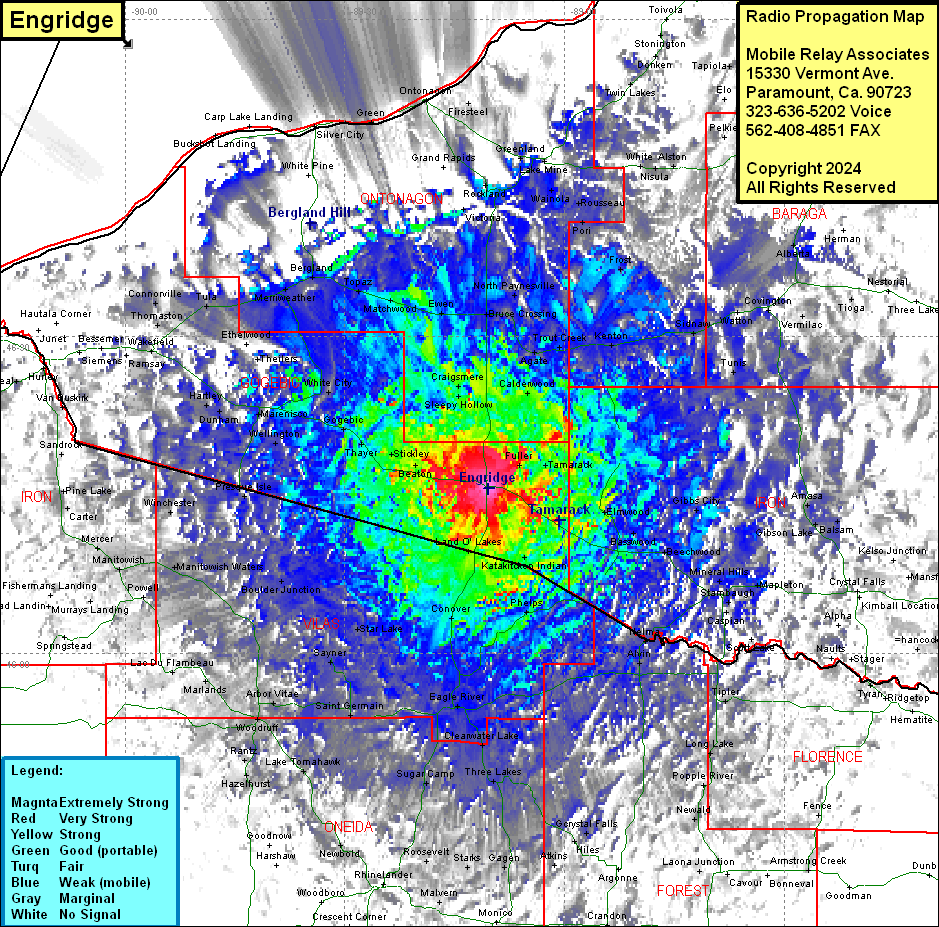 Engridge Coverage |
| Latitude: | 046 15 38.2N | 46.2606111 |
| Longitude: | 089 10 26.6W | -89.1740556 |
| Feet | Meters | |
| Ground Elevation: | 1649.0 | 502.6 |
| HAAT: | 134.6 | 41.0 |
| City: | Watersmeet | |
| County: | Gogebic | |
| State: | Michigan |
This is not an MRA Owned Site. For space rental contact the site owner.
Do you own or manage this site? Click Here
Would you like to add a site to the Google Earth Map?? Click Here
Site Coverage: Coverage of Ontonagon, Gogebic Counties, parts of Iron, Baraga, Houghton, Iron (WI), Vilas (WI), Oneida (WI), Forest (WI), Florence (WI), Lincoln (WI) Counties