Hungerford
| Site Name: | Hungerford | 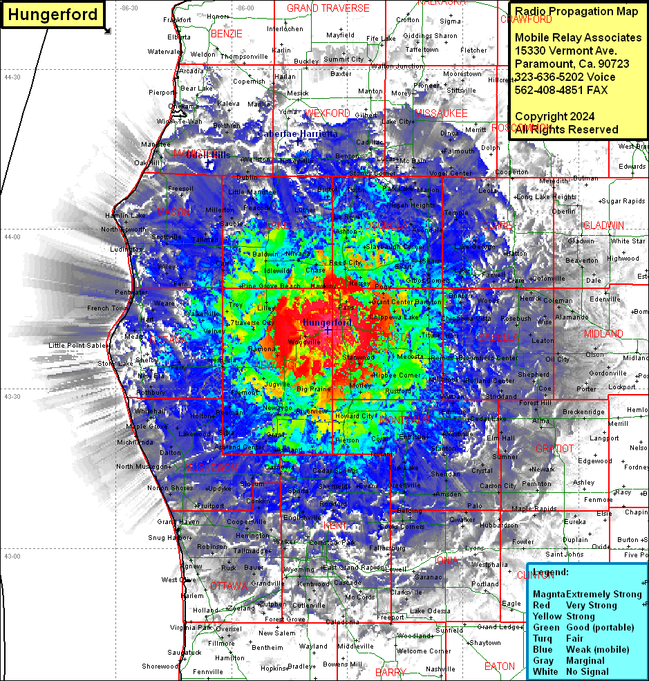 Hungerford Coverage |
| Latitude: | 043 41 03.1N | 43.6841944 |
| Longitude: | 085 34 57.2W | -85.5825556 |
| Feet | Meters | |
| Ground Elevation: | 1358.0 | 413.9 |
| HAAT: | 438.0 | 133.5 |
| City: | Woodville | |
| County: | Newaygo | |
| State: | Michigan |
This is not an MRA Owned Site. For space rental contact the site owner.
Do you own or manage this site? Click Here
Would you like to add a site to the Google Earth Map?? Click Here
Site Coverage: Coverage of Newaygo, Mecosta, Lake, Osceola Counties, parts of Montcalm, Kent, Isabella, Clare, Missaukee, Wexford, Manistee, Mason, Oceana, Ottawa, Ionia, Gratiot, Midland, Gladwin, Roscommon, Missaukee, Benzie, Grand Traverse, Kalkaska, Clinton, Barry, Allegan, Ottawa Counties