Tamarack
| Site Name: | Tamarack | 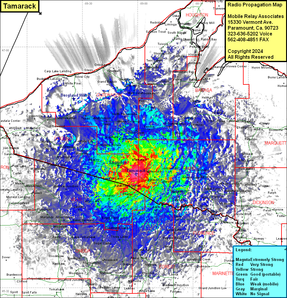 Tamarack Coverage |
| Latitude: | 046 12 32.4N | 46.2090000 |
| Longitude: | 089 00 46.0W | -89.0127778 |
| Feet | Meters | |
| Ground Elevation: | 1772.0 | 540.1 |
| HAAT: | 276.8 | 84.4 |
| City: | Tamarack | |
| County: | Gogebic | |
| State: | Michigan |
This is not an MRA Owned Site. For space rental contact the site owner.
Do you own or manage this site? Click Here
Would you like to add a site to the Google Earth Map?? Click Here
Site Coverage: Coverage of parts of Gogebic, Ontonagon, Iron, Houghton, Baraga, Marquette, Dickinson, Florence (WI), Marinette (WI), Forest (WI), Oneida (WI), Vilas (WI), Langlade (WI), Lincoln (WI), Price (WI)