Tie Hill
| Site Name: | Tie Hill | 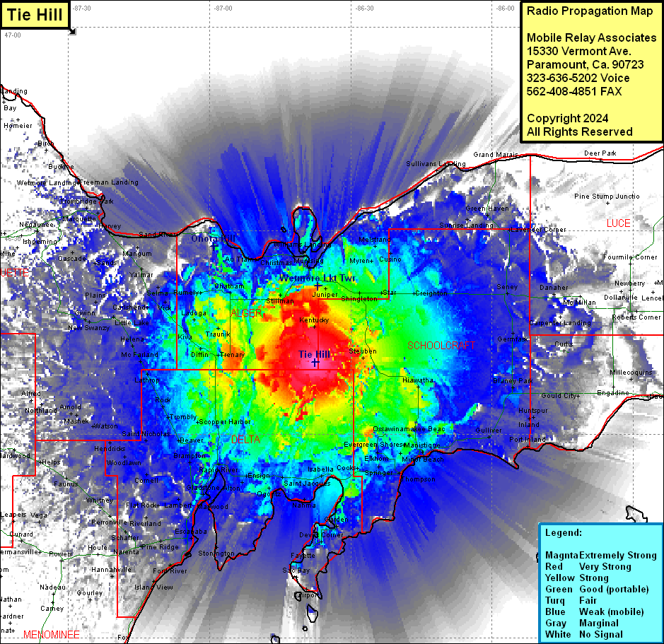 Tie Hill Coverage |
| Latitude: | 046 10 42.3N | 46.1784167 |
| Longitude: | 086 37 35.4W | -86.6265000 |
| Feet | Meters | |
| Ground Elevation: | 989.0 | 301.4 |
| HAAT: | 281.0 | 85.7 |
| City: | Kentucky | |
| County: | Alger | |
| State: | Michigan |
This is not an MRA Owned Site. For space rental contact the site owner.
Do you own or manage this site? Click Here
Would you like to add a site to the Google Earth Map?? Click Here
Site Coverage: Coverage of Schoolcraft, Delta, Alger Counties, parts of Marquette, Dickinson, Menominee, Luce, MacKinac Counties