Cedar Mtn II
| Site Name: | Cedar Mtn II | 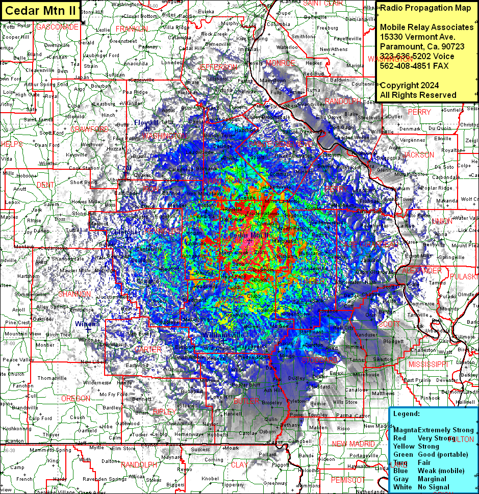 Cedar Mtn II Coverage |
| Latitude: | 037 27 13.0N | 37.4536111 |
| Longitude: | 090 22 33.7W | -90.3760278 |
| Feet | Meters | |
| Ground Elevation: | 1324.0 | 403.6 |
| HAAT: | 666.8 | 203.3 |
| City: | Millcreek | |
| County: | Madison | |
| State: | Missouri |
This is not an MRA Owned Site. For space rental contact the site owner.
Do you own or manage this site? Click Here
Would you like to add a site to the Google Earth Map?? Click Here
Site Coverage: Coverage of Madison, Bollinger, Wayne Counties, parts of Saint Francois, Sainte Genevieve, Washington, Iron, Reynolds, Carter, Shannon, Oregon, Ripley, Dent, Texas, Butler, Stoddard, Scott, New Madrid, Mississippi, Jefferson, Franklin, Crawford, Saint Louis, Saint Clair (IL), Monroe (IL), Randolph (IL) Jackson (IL), Union (IL), Alexander (IL), Pulaski (IL), Clay (AR), Randolph (AR) Counties