Fletcher
| Site Name: | Fletcher | 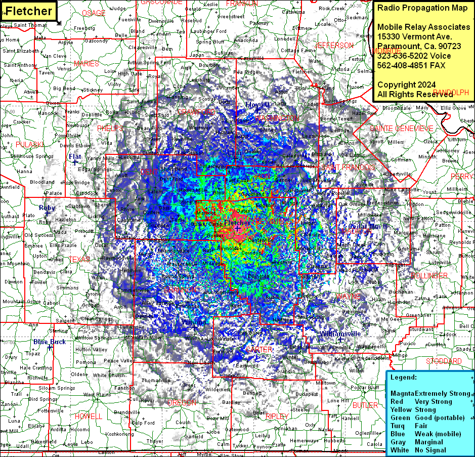 Fletcher Coverage |
| Latitude: | 037 28 09.0N | 37.4691667 |
| Longitude: | 091 05 18.5W | -91.0884722 |
| Feet | Meters | |
| Ground Elevation: | 1261.0 | 384.4 |
| HAAT: | 252.1 | 76.8 |
| City: | West Fork | |
| County: | Reynolds | |
| State: | Missouri |
This is not an MRA Owned Site. For space rental contact the site owner.
Do you own or manage this site? Click Here
Would you like to add a site to the Google Earth Map?? Click Here
Site Coverage: Coverage of Reynolds County, parts of Iron, Dent, Crawford, Washington, Saint Francois, Jefferson, Sainte Genevieve, Perry, Hollinger, Madison, Wayne, Bollinger, Butler, Carter, Ripley, Oregon, Howell, Texas, Phelps, Pulaski, Maries, Gasconade, Franklin, Randolph (AR), Monroe (IL) Counties