Lohmer Tower
| Site Name: | Lohmer Tower | 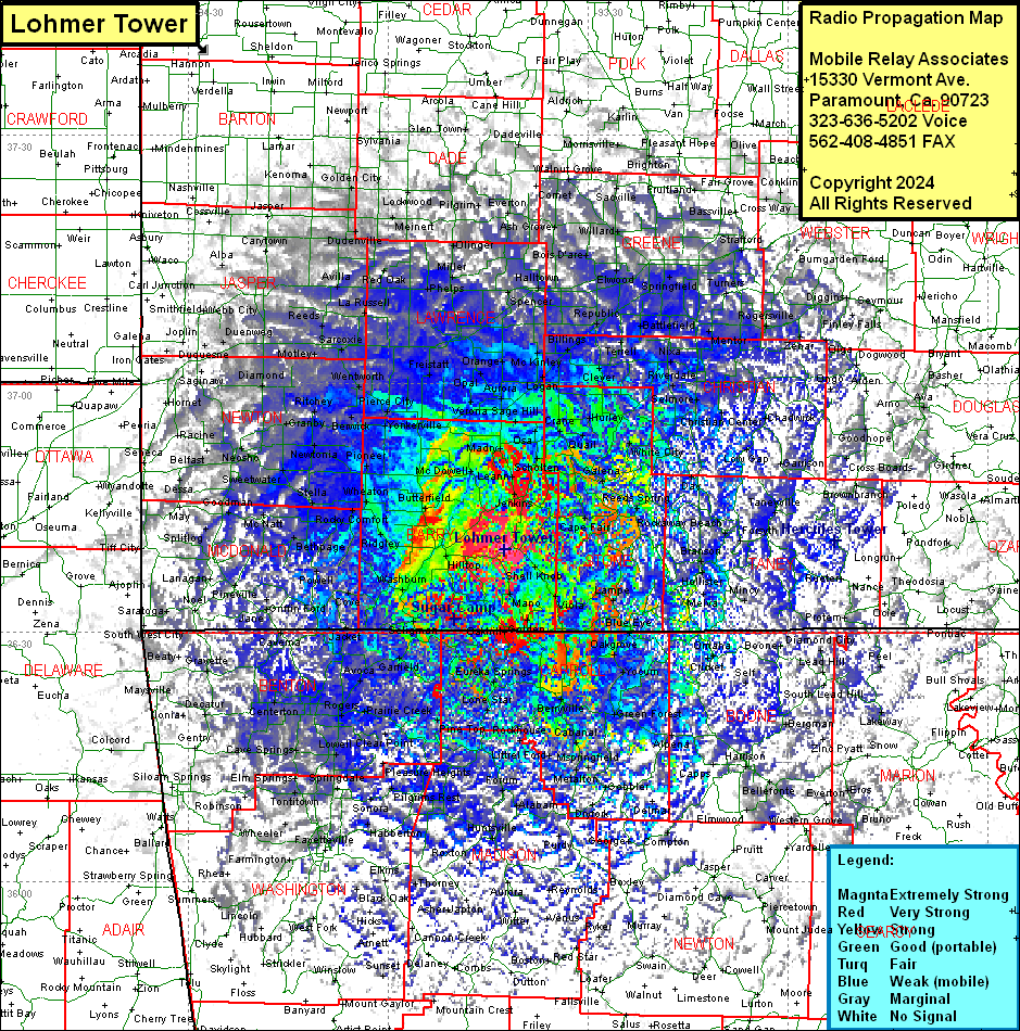 Lohmer Tower Coverage |
| Latitude: | 036 40 00.5N | 36.6668056 |
| Longitude: | 093 42 31.9W | -93.7088611 |
| Feet | Meters | |
| Ground Elevation: | 1578.0 | 481.0 |
| HAAT: | 418.8 | 127.6 |
| City: | Hill City | |
| County: | Barry | |
| State: | Missouri |
This is not an MRA Owned Site. For space rental contact the site owner.
Do you own or manage this site? Click Here
Would you like to add a site to the Google Earth Map?? Click Here
Site Coverage: Coverage of Barry, Stone Counties, parts of McDonald, Newton, Jasper, Lawrence, Dade, Cedar, Barton, Greene, Polk, Dallas, Webster, Wright, Douglas, Ozark, Baxter (AR), Boone (AR), Carroll (AR), Madison (AR), Marion (AR), Searcy (AR), Newton (AR), Washington (AR) Counties