Black Butte
| Site Name: | Black Butte |  Black Butte Coverage |
| Latitude: | 048 51 52.5N | 48.8645833 |
| Longitude: | 115 07 31.4W | -115.1253889 |
| Feet | Meters | |
| Ground Elevation: | 4023.0 | 1,226.2 |
| HAAT: | 614.2 | 187.2 |
| City: | Redford | |
| County: | Lincoln | |
| State: | Montana |
This is not an MRA Owned Site. For space rental contact the site owner.
Do you own or manage this site? Click Here
Would you like to add a site to the Google Earth Map?? Click Here
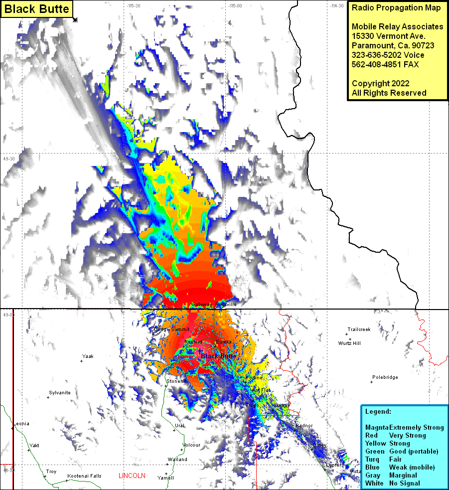
Site Coverage: Coverage of Gateway, Roosville, Redford, Eureka, Tobacco, Fortine, Ant Flat, Trego, Stryker, Radnor, Olney, Lupfer, US Highway 93 from Montana Highway 37 heading south past Round Prairie, Montana Highway 37 heading south from the intersection with US Highway 93 heading south past Rexford, US Highway 93 heading north from Eureka to the Roosville at the Canadian border and beyond into Canada (operating authority into Canada is not guaranteed)
