Bowrey Peak
| Site Name: | Bowrey Peak |  Bowrey Peak Coverage |
| Latitude: | 048 10 54.9N | 48.1819167 |
| Longitude: | 109 41 05.7W | -109.6849167 |
| Feet | Meters | |
| Ground Elevation: | 6150.0 | 1,874.5 |
| HAAT: | 1,728.1 | 526.7 |
| City: | Rocky Boy | |
| County: | Hill | |
| State: | Montana |
This is not an MRA Owned Site. For space rental contact the site owner.
Do you own or manage this site? Click Here
Would you like to add a site to the Google Earth Map?? Click Here
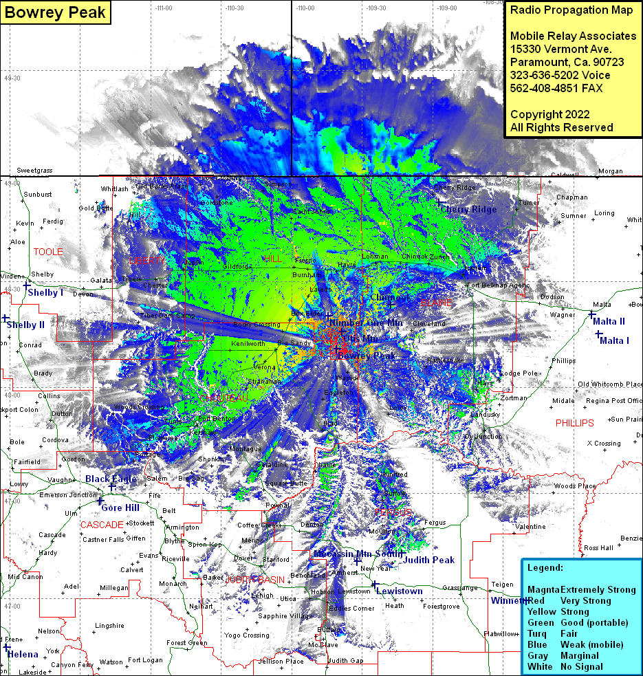
Site Coverage: Coverage of Shambo Springs, Lloyd, Cleveland, Havre, Lohman, Chinook, North Fork, Harlem, Fort Belknap Agency, Cherry Ridge, Hogeland, Turner, Savoy, Coburg, Sumner, Dodson, Wagner, Chapman, Warrick, Maddux, Rattlesnake, Leroy, Winifred, Hays, Lodge Pole, Landusky, Dy Junction, Deerfield Colony, Ware, Amherst, Hilger, Suffock, Big Sandy, Verona, Coal Banks Landing, Stranahan, Lippard, Eagleton, Illiad, Ohavre, Hoosac, Holin, Hauck, Sipple, Buffalo, McClave, Samples Crossing, Deerfield Colony, Danvers, Ware, Amherst, Kalin, Mocassin, Stanford, Arrow Creek, Geraldine, Montague, Big Sandy, Verona, Kenilworth, Coal Banks Landing, Stranahan, Lippard, Fort Benton, Kershaw, Tunis, Carter, Floweree, Woods Crossing, Lander Crossing, Shepherd Crossing, Big Sag, Highwood, Waltham, Portage, Sheffels, Fields. Cooper, Rainbow, Rocky Crossing, Rocky Boy, Laredo, Box Elder, Pacific Junction, Burnham, Fresno, Kremlin, Gilford, Higham, Rudyard, Inverness, Joplin, Buelow, Iverness, Chester, Tiber, Lothair, Hill, Fox Crossing, Goldstone, Simpson, Saint Johns, many areas in Canada which may not be legal to use with your radio.
