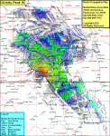
Grizzly Peak III
| Site Name: | Grizzly Peak III |  Grizzly Peak III Coverage |
| Latitude: | 045 10 48.3N | 45.1800833 |
| Longitude: | 109 21 23.1W | -109.3564167 |
| Feet | Meters | |
| Ground Elevation: | 9370.0 | 2,856.0 |
| HAAT: | 2,426.8 | 739.7 |
| City: | Washoe | |
| County: | Carbon | |
| State: | Montana |
This is not an MRA Owned Site. For space rental contact the site owner.
Do you own or manage this site? Click Here
Would you like to add a site to the Google Earth Map?? Click Here
Site Coverage: Coverage of Simpkins Place, Fox, Roberts, Selmes, Boyd, Joliet, Rockvale, Edgar, Fromberg, Bridger, Wade, Silesia, Spurling, Park City, Columbus, Springtime, Craver, Bowler, Pryor, Aroundup, Soda Springs, Laurel, Mossmain, Hesper, Baseline, Rimrock, Acton, Comanche, Molt, Broadview, Belmont, Lavina, Ryegate, Barber, Bundy, Elso, Rothiemay, Cline, Hirsch, Huntley, Shepherd, Worden, Mann, Nibbe, Pompeys Pillar, Anita, Corinth, Indian Arrow, Toluca, Romley, Soda Springs, Richet Lodge, Washoe, Belfry, Wade, Warren, Frannie, Elk Basin, Badger Basin, Kamms Comer, O’donnell, Rairden, Powell, Garland, Mantua, Deaver, Cowley, Lovell, Byron, Kane, Himes, Spence, Stucco, Emblem, Fenton, Lone Tree Crossing, Otto, Rairden, Greybull, Reeves Corner, Flitners Corner, Shell, Himes, Spence, Stucco, Rankin Place, Luther, George Place, Alex Boggio Place, Peterson Place, Fishtail, Absarokee, Dean, Beehive, Nye, Limestone, Meyers Creek, Kharllowton, Greycliff, Quebec, Reed Point, Springdale Colony, Big TImber, Sourdough, McLeod, Sioux Crossing, Melville, Shawnut, Living Springs, Barber
