Judith Peak
| Site Name: | Judith Peak |  Judith Peak Coverage |
| Latitude: | 047 13 04.0N | 47.2177778 |
| Longitude: | 109 13 16.3W | -109.2211944 |
| Feet | Meters | |
| Ground Elevation: | 6412.0 | 1,954.4 |
| HAAT: | 1,952.9 | 595.2 |
| City: | Brooks | |
| County: | Fergus | |
| State: | Montana |
This is not an MRA Owned Site. For space rental contact the site owner.
Do you own or manage this site? Click Here
Would you like to add a site to the Google Earth Map?? Click Here
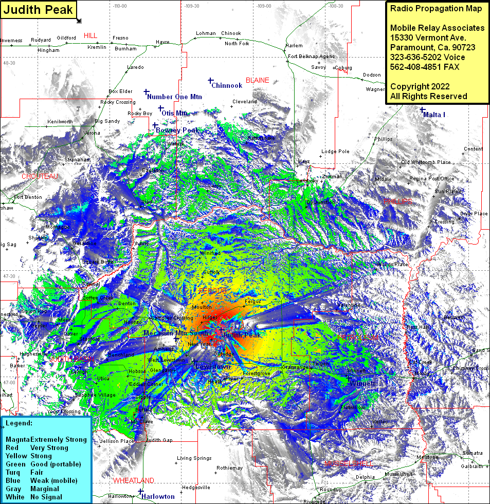
Site Coverage: Coverage of Fergus, Roy, Valentine, Woods Place, Dryer Place, Sun Prairie, Regina Port Office, Old Whitcomb Place, Dy Junction, Landusky, Rattlesnake, Forestgrove, Berket, Grassrange, Taigen, Giltedge, Maiden, Winnett, Mosby, Cat Creek, Flatwillow, Kelley, Bascom, Belmont, Broadview, New Year, Brocks, Baxter, Spring Creek Junction, West Lewiston, Ross Fork, Amherst, Ware, Kolin, Glengamy, Eddies Corner, Moore, Sipple, Hauck, Hobson, Moccasin, Benchland, WIndham, Stanford, Dover, Lehigh, Utica, Sapphire Village, Yogo Crossing, Buffalo, McClave, Garmeill, Judith Gap, Heath, Hilger, Moulton, Suffolk, Winifred, Danvers, Deerfield Colony, Samples Crossing, Hoosac, Denton, Coffee Creek, Arrow Creek, Dover, Merino, Geyser, Spion Kop, Geraldine, Square Butte, Ohavre, Iliad, Eagleton, Leroy, Warrick, Maddux, Tunis, Coal Banks Landing, Verona, Big Sandy
