Sidney I
| Site Name: | Sidney I |  Sidney I Coverage |
| Latitude: | 047 42 42.2N | 47.7117222 |
| Longitude: | 104 21 25.7W | -104.3571389 |
| Feet | Meters | |
| Ground Elevation: | 2638.0 | 804.1 |
| HAAT: | 363.9 | 110.9 |
| City: | Sidney | |
| County: | Richland | |
| State: | Montana |
This is not an MRA Owned Site. For space rental contact the site owner.
Do you own or manage this site? Click Here
Would you like to add a site to the Google Earth Map?? Click Here
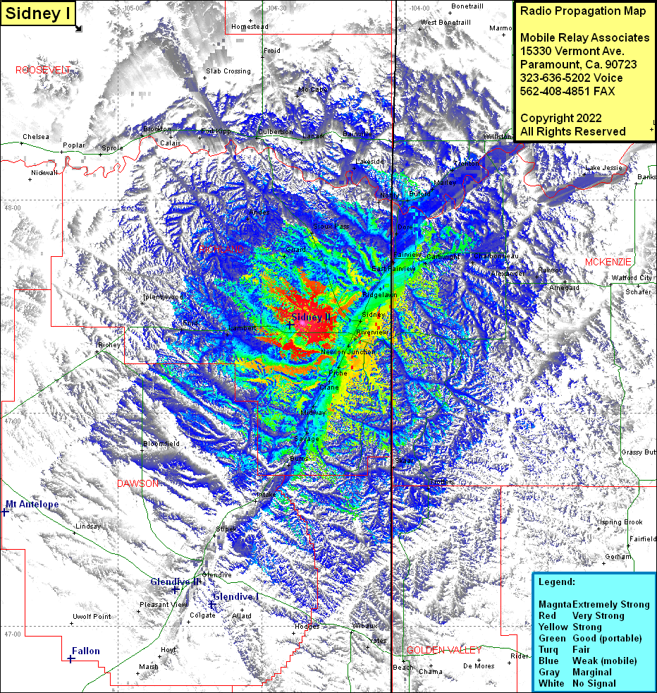
Site Coverage: Coverage of Sidney, Wooley, Ridgelawn, Ludington, East Fairview, Fairview, Cartwright, Charbonneau, Alexander, Rawson, Amegard, Dore, Buford, Nobly, Snowden, Lakeside, Lanark, Buford, Marley, Trenton, Williston, Avoca, Wheelock, West Bonetrail, Riverview, Newton Junction, Piche, Crane, Midway, Hoffmanville, Savage, Skaar, Trotters, Ispring Brook, Grassy Butte, Fairfield, Beach, Yater, WIlbaux, Saint Phillip, Chama, Lambert, Enid, Burns, Red Top, Bloomfield, Richey, Intake, Glendive, Hungry Joe, Hoyt, Pleasant View, Plentywood, Girard, Andes, Culbertson, Blair, Fort Kipp, Calais, Brockton, Sprole, McCabe, Froid, Homestead, Rock Crossing
