Jacks Peak
| Site Name: | Jacks Peak |  Jacks Peak Coverage |
| Latitude: | 041 30 30.8N | 41.5085556 |
| Longitude: | 115 59 18.9W | -115.9885833 |
| Feet | Meters | |
| Ground Elevation: | 10442.0 | 3182.7 |
| HAAT: | 3435.0 | 1047.0 |
| City: | Deep Creek | |
| County: | Elko | |
| State: | Nevada |
This is not an MRA Owned Site. For space rental contact the site owner.
Do you own or manage this site? Click Here
Would you like to add a site to the Google Earth Map?? Click Here
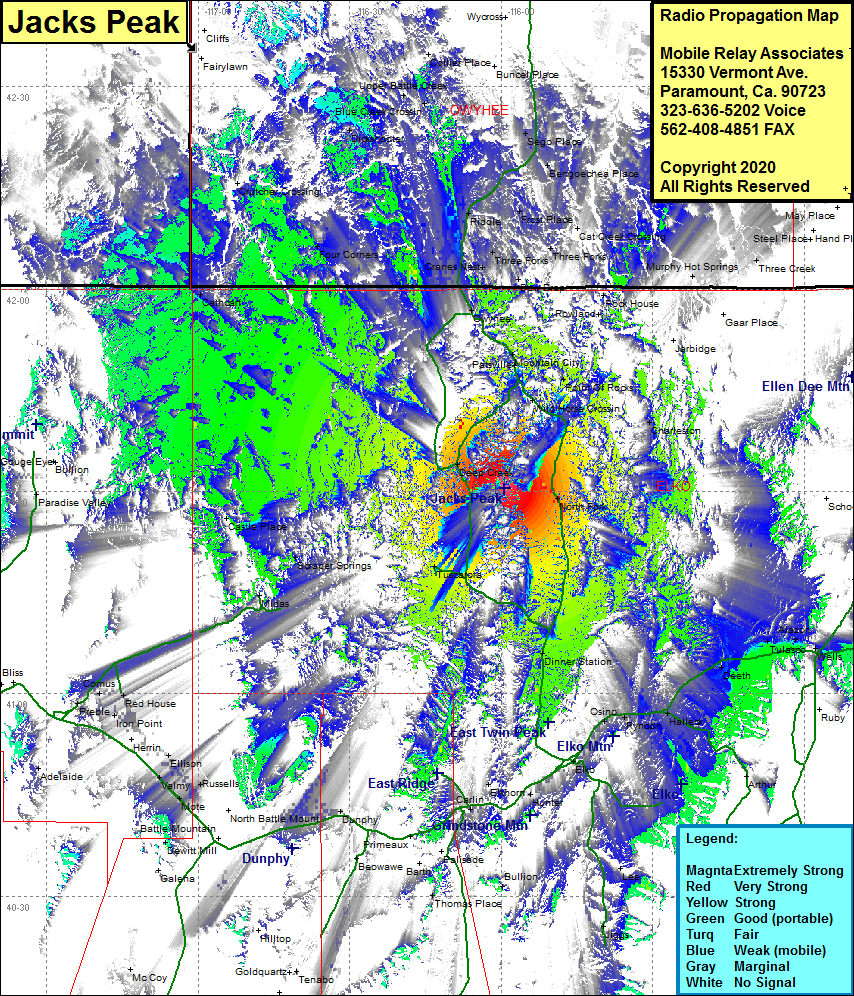
Site Coverage: Coverage of the northcentral and western area of Elko County, Nevada Hwy 225 from north of Elko to north of the Idaho state line, Nevada Hwy 226 from Hwy 225 to Nevada Highway 11, Dinner Station, Deep Creek, Wild Horse Crossing, Mountain City, Gwyhee, Charleston, Tyndon, Halleck, Deeth, Alazon, Wells, Tulasco, Rixies, Iron Point, Red House, Scraper Springs, Rowland, Rock House, Cranes Nest, Miller Creek, Three Forks, China Hat, Frost Place, Riddle, Cat Creek Crossing, Black Rock Crossing, Sago Place, Bengoechea Place, Dickshooter, Upper Battle Creek
