Knoll Mountain
| Site Name: | Knoll Mountain |  Knoll Mountain Coverage |
| Latitude: | 041 37 53.4N | 41.6315000 |
| Longitude: | 114 37 40.8W | -114.6280000 |
| Feet | Meters | |
| Ground Elevation: | 8638.0 | 2632.9 |
| HAAT: | 2343.9 | 714.4 |
| City: | Shores | |
| County: | Elko | |
| State: | Nevada |
This is not an MRA Owned Site. For space rental contact the site owner.
Do you own or manage this site? Click Here
Would you like to add a site to the Google Earth Map?? Click Here
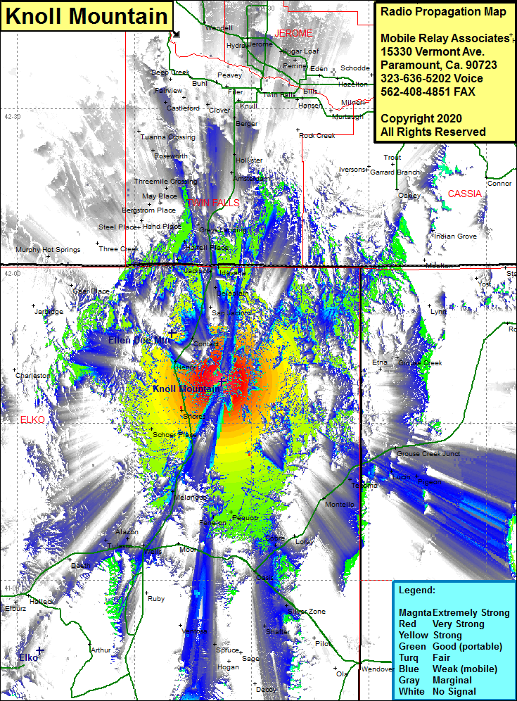
Site Coverage: Coverage of the northeastern portion of Elko County, US Highway 93 from the intersection of Interstate 80 going north past the Idaho state line to Hollister, Shores, Henry, Contact, San Jacinto, Delaplain, Idavada, Jackpot, Duncan Place, Player Place, Harrell Place, Greys Landing, Rogerson, Amsterdam, Hollister, Berger, Clover, Knull, Threemile Crossing, May Place, Hoelzle Place, Anderson Place, Steel Place, Shores, Wilkins, Melandco, Pequop, Fenelon, Holborn, Oasis, Silver Zone, Shafter, Spruce, Alazon, Wells, Holborn, Fenelon, Pequop, Moor
