Sober Peak
| Site Name: | Sober Peak | 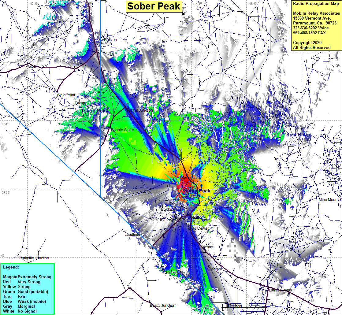 Sober Peak Coverage |
| Latitude: | 037 00 32.4N | 37.0090000 |
| Longitude: | 116 47 33.0W | -116.7925000 |
| Feet | Meters | |
| Ground Elevation: | 4937.7 | 1505.0 |
| HAAT: | 806.1 | 245.7 |
| City: | Beatty | |
| County: | Nye | |
| State: | Nevada |
This is not an MRA Owned Site. For space rental contact the site owner.
Do you own or manage this site? Click Here
Would you like to add a site to the Google Earth Map?? Click Here
Site Coverage: Coverage of Springdale, Gold Center, Carrara, Ashton, Leeland, Rhyolite, Gold Bar, Bullfrog, Bonnie Claire, Scottys Junction, Tokop, Highway 95 from Carrara to north of Highway 266, some of Highway 266