Stone Cabin
| Site Name: | Stone Cabin | 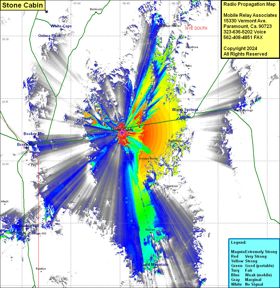 Stone Cabin Coverage |
| Latitude: | 038 06 41.6N | 38.1115556 |
| Longitude: | 116 44 21.7W | -116.7393611 |
| Feet | Meters | |
| Ground Elevation: | 6593.0 | 2009.5 |
| HAAT: | 641.5 | 195.5 |
| City: | Warm Springs | |
| County: | Nye | |
| State: | Nevada |
This is not an MRA Owned Site. For space rental contact the site owner.
Do you own or manage this site? Click Here
Would you like to add a site to the Google Earth Map?? Click Here
Site Coverage: Coverage of Warm Springs, a portion of US Highway 6, Golden Arrow, Mellan, Bellehelen, Tonopah, Florence Hill, Goldfield, West Spring, Gemfield