Huckleberry Mtn
| Site Name: | Huckleberry Mtn |  Huckleberry Mtn Coverage |
| Latitude: | 038 47 43.2N | 38.7953333 |
| Longitude: | 120 03 43.7W | -120.0621389 |
| Feet | Meters | |
| Ground Elevation: | 8828.0 | 2690.8 |
| HAAT: | 1,380.0 | 420.62 |
| City: | Echo Lake | |
| County: | El Dorado | |
| State: | California |
This is not an MRA Owned Site. For space rental contact the site owner.
Do you own or manage this site? Click Here
Would you like to add a site to the Google Earth Map?? Click Here
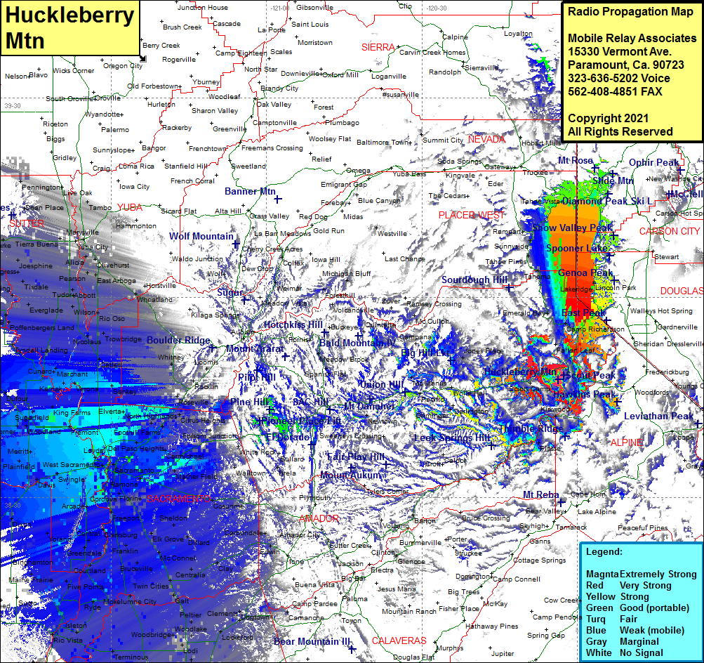
Site Coverage: Coverage of Phillips, Echo Lake, Mevers, Fallen Leaf, Fountain Place, Sciots Camp, Upper Forni, Lower Forni, Kyburz, White Hall, McConnel Place, Short Place, Griminger, Morrison, Voss, Bonetti, Capps Crossing, Caldor, Tahoe Valley, Camp Richardson, Inspiration Point, Emerald Bay, Meeks Bay, Tahoma, Homewood, Idlewild, Sunnyside, Tahoe City, Lake Forest, Camelian Bay, Kings Beach, Brockway, Tahoe Vista, Incline Village, Crystal Bay, Glenbrook, Lakeridge, Lincoln Park, Skyland, Zephyr Cove, Tahoe Village, Edgewood, Stateline, South Lake Tahoe, Lake Valley, Tallac Village, Kiva Beach, White Hall, Fresh Pond, Old Fort Jim, Tiger Lily, Outingdale, Malby Crossing, Live Oak, Tambo, Melto, Dantoni, Marysville, Yuba City, Dean Place, Tierra Buena, Bogue, Alicia, Olivehurst, Oswald, East Arboga, Horstville, Wheatland, Sheridan, Clayton, Whitney, Rocklin, Roseville, Citrus Heights, Fair Oaks, Carmichael, Rancho Cordova, Ben Ali, Del Pasa, North Highlands, Rio Linda, Bombay, Counsman, Sankey, Catlett, Trowbridge, Rio Oso, Tudor, Abbott, Wilson, Nicolaus, Tierra Buena, Lira, Meridian, Grimes, Josephine, Progress, Hinsdale, Cranmore, Millers Landing, Subaco, Kirkville, Robbins, Cunard, Marchant, Karmak, Verona, King Farms, Conaway, Bobbay, Woodland, Yolo, Dufour, Zamora, Dunningan, Hershey, Grimes, Esparto, Arroz, Citrona, El Rio Villa, Winters, El Macero, Davis, Plainfield, Merritt, Sacramento
