Shasta Bally Mtn
| Site Name: | Shasta Bally Mtn |  Shasta Bally Mtn Coverage |
| Latitude: | 040 36 09.7N | 40.6026944 |
| Longitude: | 122 39 03.3W | -122.6509167 |
| Feet | Meters | |
| Ground Elevation: | 6190.9 | 1887.0 |
| HAAT: | 3586.0 | 1093.0 |
| City: | Redding | |
| County: | Shasta | |
| State: | California |
This is not an MRA Owned Site. For space rental contact the site owner.
Do you own or manage this site? Click Here
Would you like to add a site to the Google Earth Map?? Click Here
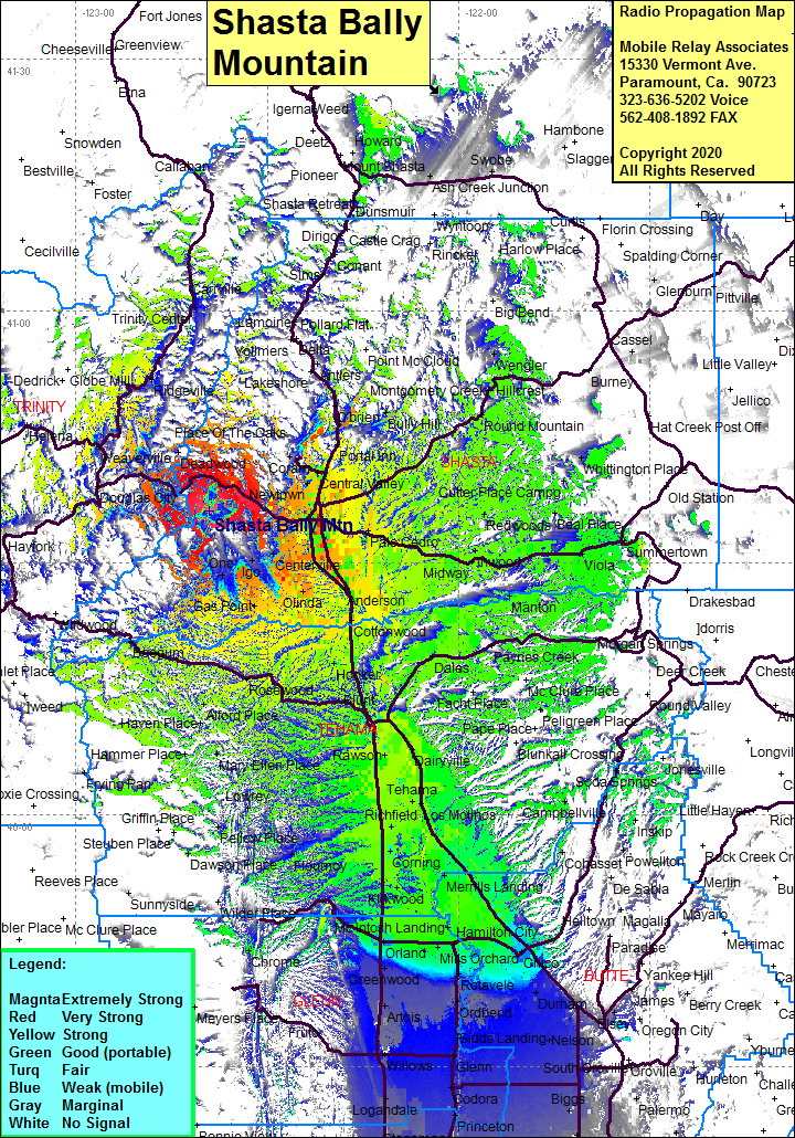
Site Coverage: Coverage of the northern portion of the San Joaquin Valley south to Sutter Butes, Redding, Cottonwood, Red Bluff, Pala Cedro, Midway Inwood, Shingletown, Central Valley, Centerville, Cloverdale, Gas Point, Rosewood, Red Bank, Mary Ellen Place, Alford Place, Platina, Olinda, Girvan, Buckeye, Cottonwood, Kiska, Dairyville, Dales, Rawson, Los Molinos, Vina, Merrills Landing, Wyo, Cory, Capay, Hamilton City, Chico Landing Greenwood
