Snow Peak II
| Site Name: | Snow Peak II |  Snow Peak II Coverage |
| Latitude: | 044 38 19.5N | 44.6387500 |
| Longitude: | 122 33 31.0W | -122.5586111 |
| Feet | Meters | |
| Ground Elevation: | 4120.0 | 1255.8 |
| HAAT: | 2147.1 | 654.5 |
| City: | Lyons | |
| County: | Linn | |
| State: | Oregon |
This is not an MRA Owned Site. For space rental contact the site owner.
Do you own or manage this site? Click Here
Would you like to add a site to the Google Earth Map?? Click Here
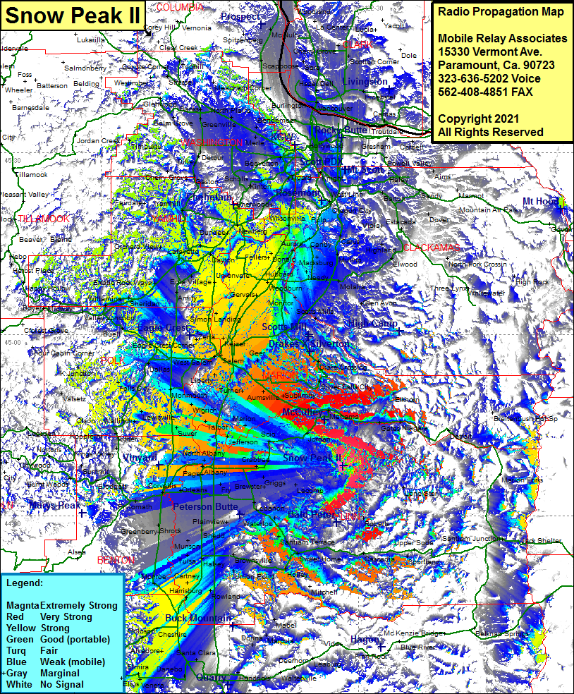
Site Coverage: Coverage of Fox Valley, Gates, Niagara, Elkhorn, Jordan, Selburn, Scio, Marion, Jefferson, Talbot, Suver, Ritner, Kopplein, Kings Valley, Nashville, Nortons, Marval, Burnt Woods, Alder, Wren, Noon, Philomath, Dry Creek, Shrock, Vendure, Corvallis, Conroy, Lewisburg, Pritle, Fry, Spicer, Whitaker, Griggs, Crabtree, Lacomb, Lenanon, Irvinville, Sodaville, Waterloo, Santiam Terrace, Sweet Home, Crawfordsville, Calapoola, Woodraffe, Union Point, Brownsville, Halsey, Rowland, Harrisburg, Cartner, Lancaster, Monroe, Miller, Bellfountain, Alpine Jct, Bear Creek, Junction City, Mabel, Union Point, Crawfordsville, Calapooia, Woodraffe, Sweet Home, Casadia, Roberts, Lone Star, Scotts Mills, WIlhoit, Glen Avon, Fernwood, Colton, Clarkes, Massinger Corner, Viola, Estacada, George, Dover, Eagle Creek, Paradise Park, Barton, Sandy, Wilson Corner, Haley, Orient, Gesham, Jenne, Harmony, Lest Linn, Oregon City, Redland, Fishers Corner, Massinger Corner, Clarkes, Union Mills, Dryland, Rural Dell, Molalla, Oaklawn, Woodburn, Mount Angel, Gervais, Tompkins Landing, Unionvale, Simon Landing, Lakebrook, Bethel, WInch, Amity, Eola Village, Erratic Rock Waysi, Bellevue, Sheridan, Willamina, Midway, Valley Jct, Boyer, Buell, Smithfield, Ellendale, Dallas, Falls City, Black Rock, K Junctiom, Valsetz, Olson, Maple Grove, Lewisville, Link, Kopplein, Wallinch
