Barber Mtn
| Site Name: | Barber Mtn | 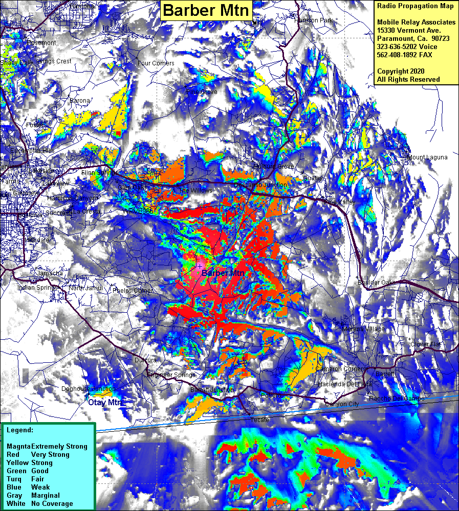 Barber Mtn Coverage |
| Latitude: | 032 44 37.8N | 32.7438333 |
| Longitude: | 116 41 33.5W | -116.6926389 |
| Feet | Meters | |
| Ground Elevation: | 3061.0 | 933.0 |
| HAAT: | 697.7 | 212.7 |
| City: | Alpine | |
| County: | San Diego | |
| State: | California |
This is not an MRA Owned Site. For space rental contact the site owner.
Do you own or manage this site? Click Here
Would you like to add a site to the Google Earth Map?? Click Here
Site Coverage: Coverage of the mountainous areas of eastern San Diego County, Cameron Corners, Rancho Del Campo, Canyon City, Tecate, Potero, Engineer Springs, Dulzura, Doghouse Jct, Glen Oaks, The Willows, Descanso Jct
Amateur (ham) frequencies: