Black Mtn IV
| Site Name: | Black Mtn IV |  Black Mtn IV Coverage |
| Latitude: | 034 35 32.0N | 34.5922222 |
| Longitude: | 117 38 39.8W | -117.6443889 |
| Feet | Meters | |
| Ground Elevation: | 3427.0 | 1044.5 |
| HAAT: | 388.8 | 118.5 |
| City: | El Mirage | |
| County: | San Bernardino | |
| State: | California |
This is not an MRA Owned Site. For space rental contact the site owner.
Do you own or manage this site? Click Here
Would you like to add a site to the Google Earth Map?? Click Here
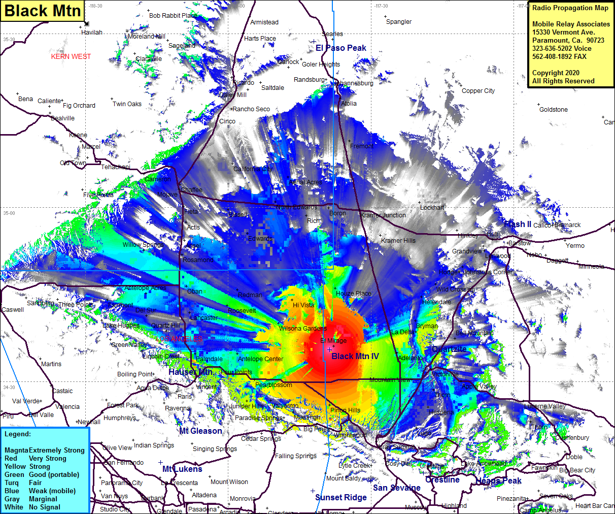
Site Coverage: Coverage of western portion of San Bernardino County and eastern portion of Los Angeles County in the high desert including Wilsona Gardens, Pearblossom, Hi Vista, Houze Place, La Delta, Bryman, Victorville, Hesperia, Adelanto, Apple Valley, Bell Mountain, Wild Crossing, Johnsons Corner, Kramer Hills, Kramer Junction, Silt, California City, Chaffee, Edwards, Actis, Boron, Rosamond, Redman, Oban, Lancaster, Palmdale, Peerland, Willow Springs, Bissell, Mojave, Aerial Acres, Fremont, Chaffee, Antelope Acres, Helendale, Bryman, La Delta, Thorn, Hesperia
Amateur (ham) frequencies:
