Cerro Gordo
| Site Name: | Cerro Gordo | 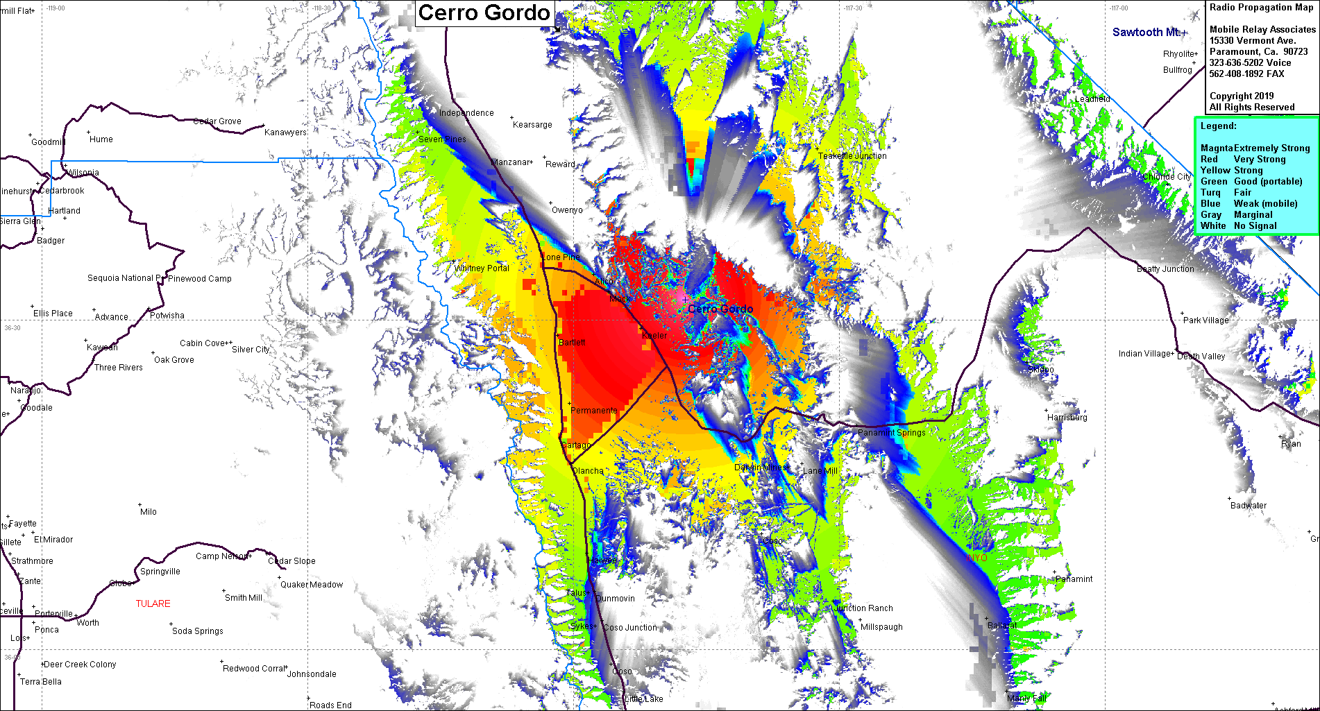 Cerro Gordo Coverage |
| Latitude: | 036 31 49.9N | 36.5305278 |
| Longitude: | 117 47 22.1W | -117.7894722 |
| Feet | Meters | |
| Ground Elevation: | 9,138.8 | 2,785.5 |
| HAAT: | 3,813.8 | 1,162.4 |
| City: | Olancha | |
| County: | Inyo | |
| State: | California |
This is not an MRA Owned Site. For space rental contact the site owner.
Do you own or manage this site? Click Here
Would you like to add a site to the Google Earth Map?? Click Here
Site Coverage: Coverage of US395 from 10 miles north of Independence and south to Dunmovin, Swansea, Keeler, east to Panamint Springs, Bartlett, Lone Pine. This site is above the Cerro Gordo Mine
