Ladera Ranch I
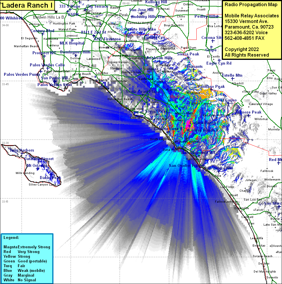
| Site Name: | Ladera Ranch I |  Ladera Ranch I Coverage |
| Latitude: | 033 33 25.0N | 33.5569444 |
| Longitude: | 117 38 45.1W | -117.6458611 |
| Feet | Meters | |
| Ground Elevation: | 541.0 | 164.9 |
| HAAT: | -9.6 | -2.9 |
| City: | Mission Viejo | |
| County: | Orange | |
| State: | California |
This is not an MRA Owned Site. For space rental contact the site owner.
Do you own or manage this site? Click Here
Would you like to add a site to the Google Earth Map?? Click Here
Site Coverage: Coverage of San Juan Hot Springs, Trabuco Canyon, Modjeska, Silverado, Beeks Place, Jofegan, San Juan Capistrano, San Onofre, Las Flores, Stuart, Capistrano Beach, Dana Point, Three Arch Bay, Laguna Niguel, Top of the World, Emerald Bay, Canyon Acres, Galivan, Mission Viejo, Laguna Hills, El Toro, Serrano Place, East Irvine, Irvine, Lido Isle, Balboa, Newport Heights, Costa Mesa, Santa Ana Heights, Huntington Beach, South Santa Ana, Como, Kathryn, Frances, Browning, Tustin, Santa Ana, Lemon Heights, Cowan Heights, La Paloma, McPherson, Orange Park Acres, Villa Park, Marlboro, South Anaheim, West Anheim, Anaheim, Garden Grove, Westminster, Barber City, Midway City, Smeltzer, Wintersburg, Sunset Beach, Surfside, Los Alamitos, Stanton, Cypress, Hawaiian Gardens, Cerritos, La Palma, Seal Beach
Amateur (ham) frequencies:
