Cicero Peak
| Site Name: | Cicero Peak | 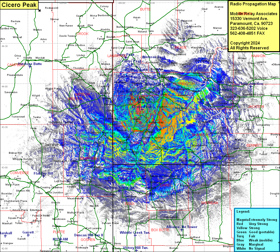 Cicero Peak Coverage |
| Latitude: | 043 40 46.0N | 43.6794444 |
| Longitude: | 103 33 40.4W | -103.5612222 |
| Feet | Meters | |
| Ground Elevation: | 6117.0 | 1864.5 |
| HAAT: | 1050.6 | 320.2 |
| City: | Custer | |
| County: | Custer | |
| State: | South Dakota |
This is not an MRA Owned Site. For space rental contact the site owner.
Do you own or manage this site? Click Here
Would you like to add a site to the Google Earth Map?? Click Here
Site Coverage: Coverage of Custer, Fall River, Pennington & Niobrara Counties, most of Weston & Dawee County, small amount of Lawrence, Meade, Haakon, Bennett, Cherry, Sheridan, Box Butte, Sioux, Goshen, Platte, Converse Counties