Custer Peak
| Site Name: | Custer Peak | 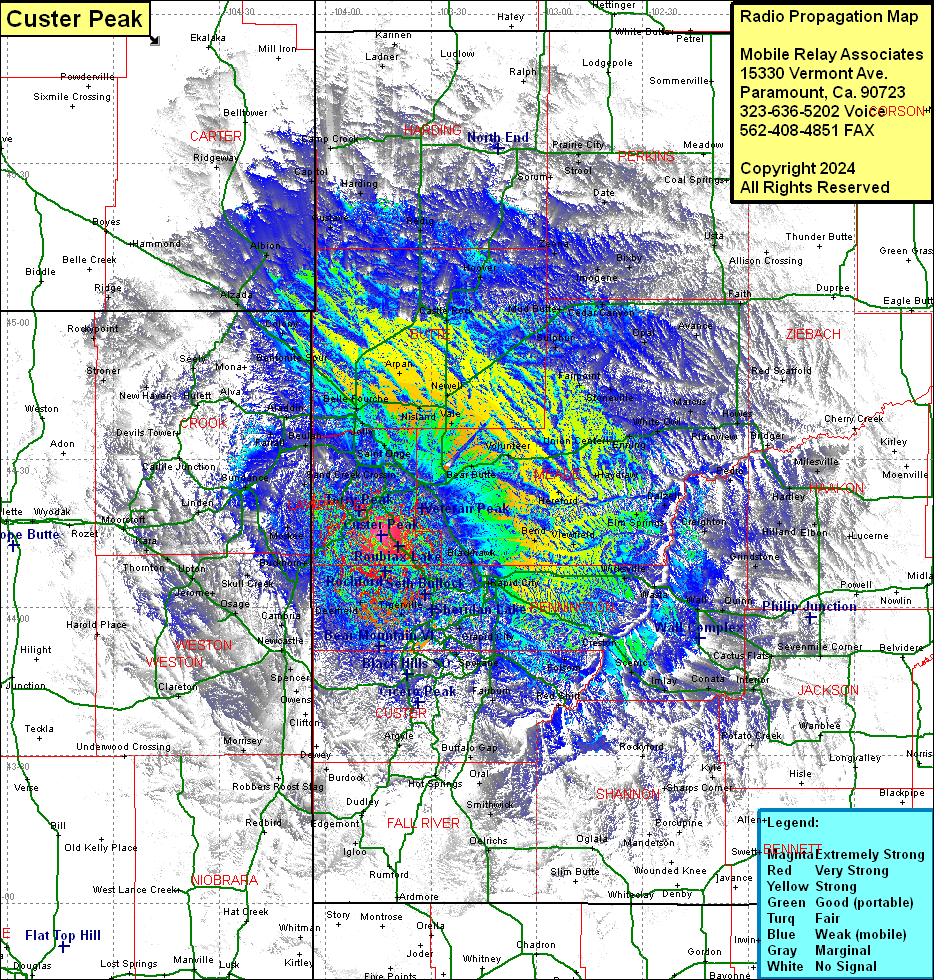 Custer Peak Coverage |
| Latitude: | 044 14 39.5N | 44.2443056 |
| Longitude: | 103 44 06.0W | -103.7350000 |
| Feet | Meters | |
| Ground Elevation: | 6805.0 | 2074.2 |
| HAAT: | 1088.1 | 331.6 |
| City: | Dumont | |
| County: | Lawrence | |
| State: | South Dakota |
This is not an MRA Owned Site. For space rental contact the site owner.
Do you own or manage this site? Click Here
Would you like to add a site to the Google Earth Map?? Click Here
Site Coverage: Coverage of Butte, Lawrence & Meade Counties, portions of Harding, Perkins, Ziebach, Haakon, Jackson, Bennett, Shannon, Fall River, Niobrara, Weston, Crook & Carter Counties