Holston Mtn
| Site Name: | Holston Mtn | 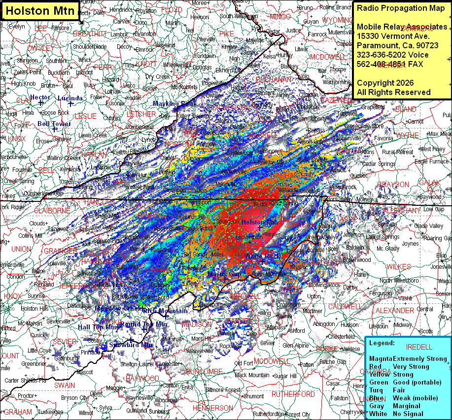 Holston Mtn Coverage |
| Latitude: | 036 25 54.6N | 36.4318333 |
| Longitude: | 082 08 14.8W | -82.1374444 |
| Feet | Meters | |
| Ground Elevation: | 4180.0 | 1274.1 |
| HAAT: | 2261.6 | 689.3 |
| City: | Elizabethon | |
| County: | Carter | |
| State: | Tennessee |
This is not an MRA Owned Site. For space rental contact the site owner.
Do you own or manage this site? Click Here
Would you like to add a site to the Google Earth Map?? Click Here
Site Coverage: Coverage of Sullivan, Carter, Johnson, Washington Counties, much of Unicoi, Greene, Hawkins Counties, some of Hamblin Counties and sporatic coverage of Claiburne, Union, Grainger, Jefferson, Union, Knox, Servier, Cocke, Blount, Haywood (NC), Buncombe (NC), McDowell (NC), Burke (NC), Cataiwba (NC), Alexander (NC), Caldwekk (NC), Wilkes (NC), Ashe (NC), Watauga (NC), Avery (NC), Mitchell (NC), Yancey (NC), Madison (NC), Bell (KY), Harlan (KY), Leslie (KY), Clay (KY), Perry (KY), Letcher (KY), Knott (KY), Floyd (KY), Pike (KY), Mingo (WV), McDowell (WV), Wyoming (WV), Mercer (WV) Counties