Morris Gap
| Site Name: | Morris Gap | 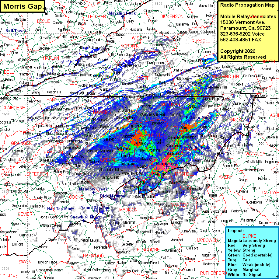 Morris Gap Coverage |
| Latitude: | 036 08 16.3N | 36.1378611 |
| Longitude: | 082 23 01.6W | -82.3837778 |
| Feet | Meters | |
| Ground Elevation: | 2763.0 | 842.2 |
| HAAT: | 297.9 | 90.8 |
| City: | Erwin | |
| County: | Unicoi | |
| State: | Tennessee |
This is not an MRA Owned Site. For space rental contact the site owner.
Do you own or manage this site? Click Here
Would you like to add a site to the Google Earth Map?? Click Here
Site Coverage: Coverage of Unicoi, Washington Counties, most of Green, Sullivan, Carter Counties, some of Johnson, Hawkins, Yancy (NC), Mitchell (NC), Washington (VA) Counties and sporatic coverage of Jefferson, Grainger, Hamblen, Hancock, Claiborne, Sevier, Haywood (NC), Buncombe (NC), McDowell (NC), Avery (NC), Watauga (NC), Ashe (NC), Harlan (KY), Kee (VA), Wise (VA), Dickenson (VA), Russell (VA), Tazewell (VA), Smyth (VA), Grayson (VA), Scott (VA) Counties