Pinnacle Mtn
| Site Name: | Pinnacle Mtn | 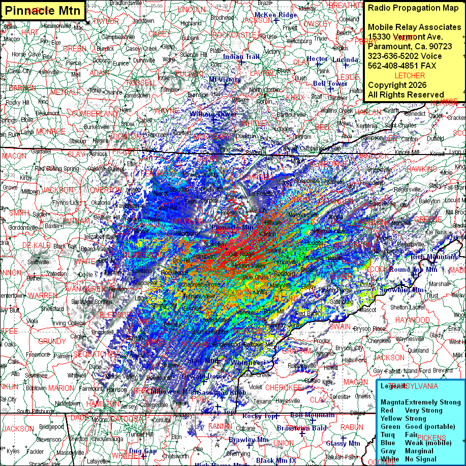 Pinnacle Mtn Coverage |
| Latitude: | 036 06 35.7N | 36.1099167 |
| Longitude: | 084 20 09.1W | -84.3358611 |
| Feet | Meters | |
| Ground Elevation: | 3342.0 | 1018.6 |
| HAAT: | 1884.6 | 574.4 |
| City: | Frost Bottom | |
| County: | Anderson | |
| State: | Tennessee |
This is not an MRA Owned Site. For space rental contact the site owner.
Do you own or manage this site? Click Here
Would you like to add a site to the Google Earth Map?? Click Here
Site Coverage: Coverage of Anderson, Morgan, Union, Knox, Loudon, Blount, Monroe, McMinn, Meigs, Rhea, Grainger, Jefferson Counties, most of Scott, Campbell, Claibourne, Cumberland, Fentress Counties, some of Polk, Bradley, Hamilton, Bledsoe, McCreary (KY) Counties and sporatic coverage of Overton, Jackson, Clay, Smith, DeKalb, Warren, White, Grundy, Sesquatchie, Marion, Macon, Pickett, Hancock, Hawkins, Monroe (KY), Cumberland (KY), Adair (KY), Metcalf (KY), Clinton (KY), Sussell (KY), Casey (KY), Wayne (KY), Pulaski (KY), Whitley (KY), Knox (KY), Laurel (KY), Rockcastle (KY), Lincoln (KY), Casey (KY), Clay (KY), Leslie (KY), Harlan (KY), Bell (KY), Lee (VA), Wise (VA), Scott (VA), Cherokee (NC), Graham (NC), Swain (NC), Haywood (NC), Madison (NC), Jackson (NC), Macon (NC), Clay (NC), Catoosa (GA), Dade (GA), Walker (GA), Whitfield (GA), Murray (GA), Fannin (GA), Union (GA) Counties